Vietnam consults stakeholders on climate change scenarios

The 2025 scenarios build on Vietnam’s 2020 projections, incorporating the latest findings from the Intergovernmental Panel on Climate Change’s sixth assessment report and insights from domestic and global partners. The focus is on extreme weather events, particularly in urban areas, and rising sea levels, which threaten Vietnam’s low-lying coastal regions. The goal is to guide policymaking, urban planning, and local adaptation strategies.

At the workshop (Photo: VNA)

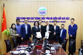
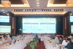
Hanoi (VNA) – A consultation workshop convened in Hanoi on July 2 to present and gather feedback on climate change projections and communication for Vietnam.

Co-hosted by the Vietnamese Ministry of Agriculture and Environment’s Institute of Meteorology, Hydrology and Climate Change (IMHEN) and the Department of Climate Change, and the UK Met Office, the event formed part of the Asia-Pacific WISER (Weather and Climate Information Services) Programme funded by the UK’s Foreign, Commonwealth and Development Office (FCDO).

It drew a diverse group of stakeholders, including government officials, researchers, academics, and representatives from organisations like the Vietnam Women’s Union and the Vietnam Youth Federation, who weighed in on tailoring climate data for practical use.

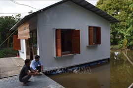
In her opening remarks, IMHEN Director Assoc. Prof. Pham Thi Thanh Nga said the 2025 scenarios build on Vietnam’s 2020 projections, incorporating the latest findings from the Intergovernmental Panel on Climate Change’s sixth assessment report and insights from domestic and global partners. The focus is on extreme weather events, particularly in urban areas, and rising sea levels, which threaten Vietnam’s low-lying coastal regions. The goal is to guide policymaking, urban planning, and local adaptation strategies.

Dr. Truong Ba Kien from IMHEN outlined the use of three socioeconomic pathway (SSP) models, including SSP1-2.6, SSP2-4.5, and SSP5-8.5, mapping out sustainable, intermediate, and high-emission futures, respectively. These align with Vietnam’s commitment to net-zero emissions by 2050.

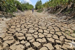
The 2025 scenarios track metrics like days exceeding 35°C, short-duration heavy rainfall, cold spells, droughts, and prolonged rains. High-resolution datasets, down to 3–5km for cities and provinces, enable precise modeling of local impacts.

A key feature is their digital accessibility. An interactive WebGIS platform allows users to search, download, and analyse data by region, sector, and timeline, boosting its utility in urban planning, agriculture, healthcare, and climate-resilient infrastructure development.

Emma Dyer from the UK Met Office shared projections from a high-resolution Convection-Permitting Model under the SSP3-7.0 pathway, forecasting a 2.0–3.7°C temperature spike by 2100 and a 0–4mm uptick in daily rainfall.

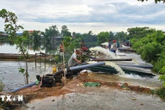
Coastal flooding risks also loomed large in discussions, alongside strategies to make complex data digestible for diverse stakeholders./.

VNA

See more

A green sea turtle returns to lay eggs on Cau Cang Beach. (Photo: VNA)

Rare sea turtle lays eggs on Lam Dong province's Hon Cau Beach

In recent years, to raise public awareness of marine conservation and sea turtle protection, the Hon Cau Marine Protected Area has actively engaged local residents and volunteers in beach patrols and nest ground monitoring. Thanks to these efforts, thousands of baby turtles have been successfully hatched and released back into the sea.

Emission inspections for motorcycles and motorised vehicles will begin in Hanoi and Ho Chi Minh City on July 1, 2027. (Photo: VNA)

Emission standards for motorcycles to be issued in July

Under the draft, motorcycles produced before 2008 will be subject to the lowest level of inspection standards, level 1, while those manufactured from 2008 onwards will be assessed to a higher standard. Similar rules will also apply to motorised vehicles, with level 1 for those manufactured before 2016.

Jonathan Wallace Baker, UNESCO Representative in Vietnam (right), presents the UNESCO Global Geopark Certificate for Lang Son to the provincial leadership. (Photo: VNA)

Lang Son becomes Vietnam’s 4th global geopark

Lang Son Global Geopark spans over 4,842 square kilometres, roughly 58% of the province, and is home to around 627,500 people. It features a rich blend of geological wonders and cultural heritage, including stunning caves and sinkholes such as Nguom Mooc Cave, Tham Lum and Ung Roac. Its biodiversity is also protected within the Huu Lien Nature Reserve.

Visitors flock to see rare insect specimens at the Da dang sac mau con trung Vietnam (The Diversity of Vietnamese Insects) exhibition at the Da Nang Museum. (Photo: nld.vn)

Da Nang exhibition features rare insects endemic to Vietnam

To run until July 13, the Da dang sac mau con trung Viet Nam (The Diversity of Vietnamese Insects) exhibition at the Da Nang Museum features hundreds of rare insect specimens, aiming to spotlight the diversity and uniqueness of the country’s endemic insects.

The Phu Ho agricultural cooperative in Phu Ho commune, Phu Vang district, Hue city mobilises manpower and pumps to drain floodwater and save rice crops for local farmers. (Photo: VNA)

PM orders strengthened disaster preparedness ahead of storm season

Under the directive, the PM instructed relevant agencies to regularly inspect, supervise and proactively implement disaster prevention, response and rescue measures in line with their assigned roles and mandates, ensuring readiness, avoiding passivity or delays, and maintaining operational continuity amid ongoing political and administrative restructuring at levels.

The research team collects seawater samples in Ha Long Bay and Cua Luc. (Photo: VNA)

Vietnam pioneers use of AI and remote sensing to monitor seawater quality

According to Dr. Vu Anh Tuan, Deputy Director General of the Vietnam Space Centre and head of the project, this is the first study in Vietnam to simultaneously employ Sentinel-2 satellite data, advanced machine learning algorithms, and the Google Earth Engine (GEE) cloud computing platform to model and monitor key seawater quality parameters.